Colorado area weather forecasts and observation
Forecasts
NWS Point Forecasts (computed generated for a specific spot, an area about 2 miles across):
Wierholm forecast (39.982 North, 105.179 West) meteogram there (meteogram in metric units)
Click on map for the forecaat at that location.NWS interactive graphical forecast tool:
Today's high temperature, lower 48
Click on any location to get a menu of other forecast products, including details for any location.
Use top menu to choose other forecasted parameter.
Drag pointer to pan; drag right button to zoom in.
Observations (current conditions)
NCAR Boulder: weather conditions observed at the NCAR Foothills Laboratory in northeast Boulder
RADAR
RADAR: 1 hour US CONUS loop, large
RADAR NE Colorado, base Reflectivity loop
Storm total precip amount, NE Colorado, estimated from RADAR (does not loop when storm is over)
SATELLITE
Colorado Vis satellite loop (CIRA)
north pacific and western US Vis loop (CIRA)
GOES-West satelllite menu (from CIRA)
NWS Satellite menu; western US
IR western US, channel 2, loop (NWS)
Western U.S. Infrared (Enhancement 3); static (colorful)
Western U.S. Infrared (Enhancement 4); static
Western U. S. Infrared Channel 4 Loop good for air mass flow
Western U. S. Water Vapor Loop, good for air mass flow
menu for enhanced satellite choices
goes 16 hemisphere - csu rammb sat slider
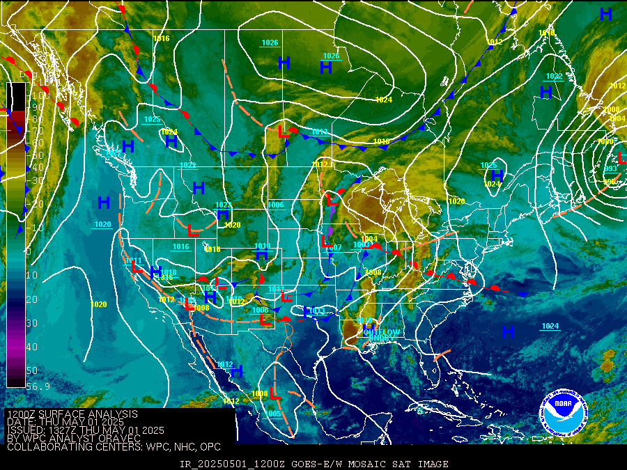
SURFACE OBS and ANALYSES with FRONTS
Analysis: fronts and surfaceobs
Analysis/Satellite Composite, 3 hourly
other...
Cities' point forecast matrices: Colorado